|
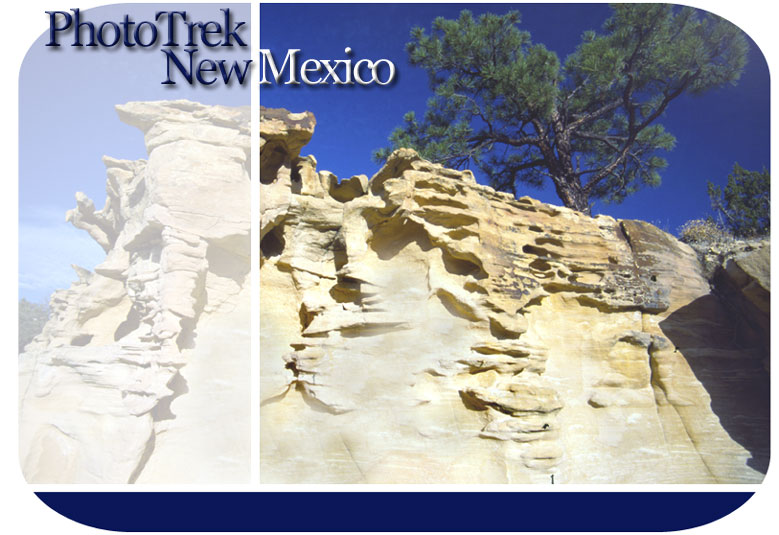
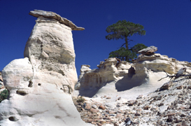
OJITO WILDERNESS Formation Name: MORRISON Rock Type(s): Sandstone, Siltstone, Shale Geologic Time Period: LATE JURASSIC Time of Deposition (millions of years ago): 150 to 144 Depositional Environment: rivers, flood plains, lakes, wetlands Common Fossils Found: Petrified wood, Sauropod dinosaurs (herbivores): Allosaur dinosaurs (carnivores) Formation Name: DAKOTA SANDSTONE Rock Type(s): Sandstone Geologic Time Period: MIDDLE CRETACEOUS Time of Deposition (in millions of years ago): 108 to 94 Depositional Environment: marine shoreline, beaches Common Fossils Found: marine invertebrates (e.g., bi-valves), fishes Formation Name: MANCOS SHALE Rock Type(s): Shale Geologic Time Period: LATE CRETACEOUS Time of Deposition (in millions of years ago): 85 to 80 Depositional Environment: marine -- terrestrial sediments washed into shallow sea Common Fossils Found: marine invertebrates (e.g., spiraled ammonites), sharks At the basin’s southeastern edge, The Ojito’s Wilderness’ countless natural sculptures and sweeping vistas are only part of the reason why it is New Mexico’s newest official wilderness area. Bonsai ponderosa pines and venerable, character laden juniper trees clinging to bare rock add to the beauty. Petrified wood litters the hoodoo galleries. Ojito’s lowest, and the San Juan Basin’s second oldest layer, the widespread, 160 million year old Morrison formation , in other southwestern states had produced the most exceptional Jurassic dinosaur fossils in the world. New Mexico seemed left out of the picture until 1985, when Ojito divulged 8 vertebrae and several leg bone fragments from the 120 feet long, 100 ton Seismosaurous which at the time was the largest dinosaur species yet discovered. Ojito’s upper two layers, the Dakota Sandstone and later Mancos Shale, chronicle an ancient ocean as it slowly expanded and flooded the basin. Deep water marine fossils characterize the Mancos layer. OJITO DIRECTIONS—Turn west off 550 about 2 miles south of San Ysidro village onto well marked Cabezon Road. Immediately take the left fork and at all the following forks take the one that appears most traveled. A sign about 4 miles in marks the wilderness area boundary. The best badlands lie in the northwest corner, but you’ll find entertaining rock forms throughout the area. FOR MORE INFO—Donna Dudley, Recreation specialist at the Albuquerque BLM office, 505-761-8700 |
A photographic tour of New Mexico’s incredible San Juan Basin Badlands.