|
DE NA ZIN WILDERNESS
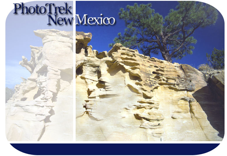
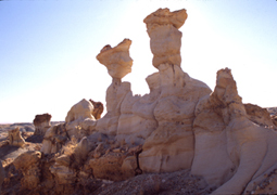
Formation Name: FRUITLAND Rock Type(s): Conglomerates, Sandstone, Siltstone, Shale, Coal Geologic Time Period: END OF CRETACEOUS Time of Deposition (in millions of years ago): 75 to 73 Depositional Environment: wetlands, swamps, river deltas along a sea retreating to the northeast Common Fossils Found: Petrified wood, crocodiles, turtles, very early mammals, dinosaurs (e.g., Pentaceratops - unique to San Juan Basin- and duck-billed Hadrosaurs) Formation Name: KIRTLAND Rock Type(s): Mostly Siltstone Geologic Time Period: END OF CRETACEOUS Time of Deposition (in millions of years ago): 73 to 70 Depositional Environment: wetlands, swamps, river deltas inland from a sea retreating to the northeast Common Fossils Found: Petrified wood, fish scales, dinosaurs (e.g., T. Rex and last of the sauropods: Allamosaurus) Formation Name: OJO ALAMO Rock Type(s): Mostly Sandstone Geologic Time Period: TERTIARY— EARLY PALEOCENE Time of Deposition (in millions of years ago): 66 to 65 ?, 65 to 64 ? Depositional Environment: Continental – rivers and streams Common Fossils Found: Flowering plant species Formation Name: NACIMIENTO Rock Type(s): Sandstone alternating with Siltstone and Shale Geologic Time Period: TERTIARY-- MIDDLE PALEOCENE Time of Deposition (in millions of years ago): 65?,64? to 58 Depositional Environment: Branching river systems and large flood plains Common Fossils Found: petrified wood, fish scales, early mammals (e.g., primates, dog-sized early hoofed varieties) Paleontologists are particularly interested in the De Na Zin Wilderness. It’s one of the rare places on earth where they can study a terrestrial fossil record spanning the 65 million year old Cretaceous-Tertiary boundary marking the demise of a 150 million year long dinosaur dynasty and the beginning of mammalian rule. The extensive lower elevation De Na Zin areas are carved from the Kirkland/Fruitland formation like the neighboring Bisti and AhShe Sle Pah badlands. But the De Na Zin’s upper areas lie in the Ojo Alamo and Nacimiento formations, adding further diversity to the doo doos. The Nacimiento formation’s erosion resistant sandstone mesa edges add relief, picturesque arches and large scale sandstone hoo doos to the mix. Petrified wood is very plentiful, including some of the largest petrified logs in the San Juan Basin, many of which actually form hoo doo and even arch tops. Higher still, thick layers of dark red and bronze sandstone form massive, crenalated hoo doos and fractured mesa edges guarding a sprawling, multi-level box canyon maze. DE NA ZIN DIRECTIONS — The badlands can be accessed from either NM highway 371 or US 550 via county road 7500. The marked parking area lies about midway (12 miles) between these two routes. The badlands are north of the road. The marked turnoff east onto 7500 from NM 371 is about 40 miles south of Farmington. The turnoff west from US 550 onto 7500 is at the Huerfano Trading Post about 15 miles south from Bloomfield. MORE INFO: Call Recreation Specialist Rich Simmons at the Farmington Area BLM Office—505-599-8900
|
A photographic tour of New Mexico’s incredible San Juan Basin Badlands.
